


Voting District 401, Kay County, Oklahoma
About
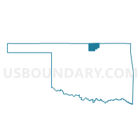
Outline

Summary
| Unique Area Identifier | 654195 |
| Name | Voting District 401 |
| County | Kay County |
| State | Oklahoma |
| Area (square miles) | 103.00 |
| Land Area (square miles) | 102.30 |
| Water Area (square miles) | 0.69 |
| % of Land Area | 99.33 |
| % of Water Area | 0.67 |
| Latitude of the Internal Point | 36.92131850 |
| Longtitude of the Internal Point | -96.83534230 |
Maps


Graphs
Select a template below for downloading or customizing gragh for Voting District 401, Kay County, Oklahoma


Neighbors
Neighoring Voting District (by Name) Neighboring Voting District on the Map
- Voting District 104, Osage County, OK
- Voting District 113, Osage County, OK
- Voting District 400, Kay County, OK
- Voting District 403, Kay County, OK
- East Bolton Voting District, Cowley County, KS
- Silverdale Township Voting District, Cowley County, KS
- Spring Creek Township Voting District, Cowley County, KS
Top 10 Neighboring County Subdivision (by Population) Neighboring County Subdivision on the Map
- Newkirk CCD, Kay County, OK (3,705)
- Bolton township, Cowley County, KS (1,705)
- Northwest Osage CCD, Osage County, OK (1,426)
- Kaw City CCD, Kay County, OK (1,170)
- Silverdale township, Cowley County, KS (354)
- Spring Creek township, Cowley County, KS (75)
Top 10 Neighboring Unified School District (by Population) Neighboring Unified School District on the Map
- Arkansas City Unified School District 470, KS (16,699)
- Newkirk Public Schools, OK (3,403)
- Shidler Public Schools, OK (1,665)
- Dexter Unified School District 471, KS (656)
Top 10 Neighboring State Legislative District Lower Chamber (by Population) Neighboring State Legislative District Lower Chamber on the Map
- State House District 36, OK (37,155)
- State House District 38, OK (32,291)
- State House District 79, KS (20,632)
Top 10 Neighboring State Legislative District Upper Chamber (by Population) Neighboring State Legislative District Upper Chamber on the Map
Top 10 Neighboring 111th Congressional District (by Population) Neighboring 111th Congressional District on the Map
Top 10 Neighboring Census Tract (by Population) Neighboring Census Tract on the Map
- Census Tract 12, Kay County, OK (4,875)
- Census Tract 4939, Cowley County, KS (3,433)
- Census Tract 4931, Cowley County, KS (2,729)
- Census Tract 9400.11, Osage County, OK (1,426)